AIS vulnerabilities in spotlight after new report
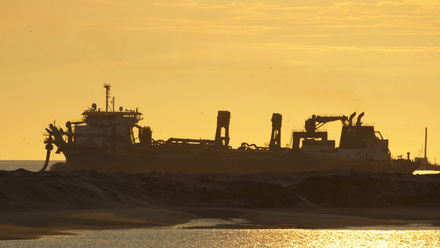
The technology offers real-time ship tracking and monitoring and is vital for safety, but bad actors are a worry.
An integration of terrestrial, shipborne and satellite Automatic Identification System (AIS) data with “SmartMatch” technology is being proffered by Lloyd’s List Intelligence as a solution to current systemic weaknesses in the accurate validation of global vessel positioning and potential safety issues.
In its newly-released seven-page whitepaper, ‘Understanding AIS technology’, the maritime intelligence and insights provider has sought to overview how AIS technology works and its inherent challenges, alongside highlighting its own “unique proposition” in response.
Describing AIS technology as a “vital tool in maritime tracking”, the report recounts that since 2002 the IMO has required AIS transceivers to be fitted to vessels over 300 gross tonnes.
“AIS was originally introduced to improve maritime safety by enabling a vessel navigator to view the identity, position and direction of other ships in their vicinity,” states the report.
“[It] works by having vessels equipped with transceivers that continuously broadcast key information, including vessel identity, position, speed, course and destination. These signals are then received by different systems, such as terrestrial, shipborne and satellite AIS, each playing a unique role in vessel tracking.
“Despite its advantages, AIS technology comes with limitations, such as signal congestion, spoofing and coverage gaps.”
IMO responds to system weaknesses
Confirming awareness of such vulnerabilities – including deliberate tampering by bad actors – IMO spokesperson Natasha Brown says for its part, the organisation is continually working to “improve and adapt” the regulatory framework in response.
“The Maritime Safety Committee (MSC 109) in 2024 adopted revised performance standards for a universal shipborne AIS, introducing measures to prevent unauthorised entry or tampering of the ship's identity information in shipborne AIS,” she said.
“Further, the recent Sub-Committee on Navigation, Communications and Search and Rescue (NCSR 12) agreed to draft amendments to SOLAS [the International Convention for the Safety of Life at Sea] chapter V to introduce the VHF Data Exchange System (VDES), along with associated performance standards and operational guidelines, for consideration by [the] upcoming session of the Maritime Safety Committee (June 2025),” explains Brown.
“VDES is expected to enhance the exchange of data and provide increased reliability and resilience for communication.”
The IMO confirmed that AIS and GNSS spoofing and jamming have been key discussion points over the past few years within its Maritime Safety Committee (MSC) and subsidiary body, the NCSR.
While the IMO continues with its work, Lloyd’s List Intelligence’s report claims its existing multi-faceted solution addresses current shortcomings with AIS, “ensuring the most accurate vessel position data”.
“Lloyd’s List Intelligence has its own global proprietary terrestrial network meaning we own our data and control its expansion into key areas. Our unique shipborne AIS network adds an even greater layer of validated positions and accuracy. Satellite AIS fills in the final gaps, our partners guarantee global coverage in deep sea areas so we can connect the full voyage.”
In other documentation, Lloyd’s List Intelligence emphasises the importance of accurate, real-time data for fleet visibility and optimisation.
“Managing a global fleet presents numerous challenges, from meeting stringent safety and compliance standards to ensuring operational efficiency across different jurisdictions. The rapid shifts in market conditions, regulatory updates, and changing trade routes can increase the chance of sanctions for maritime businesses.
“Real-time fleet visibility is critical for fleet managers, enabling them to continuously monitor vessel performance, track compliance and respond to changes quickly and accurately.”
Tell us what you think about this article by joining the discussion on IMarEST Connect.
Protect satellite navigation from interference, UN agencies urge.
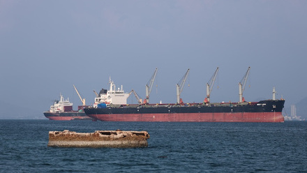
Image: multiple ships crossing the Strait of Gibraltar. Credit: Shutterstock.